There are 2 questions, whether DAC is important (sec.
1) and, if so, which one you should choose (sec.
2).
1 Is DAC really important ?
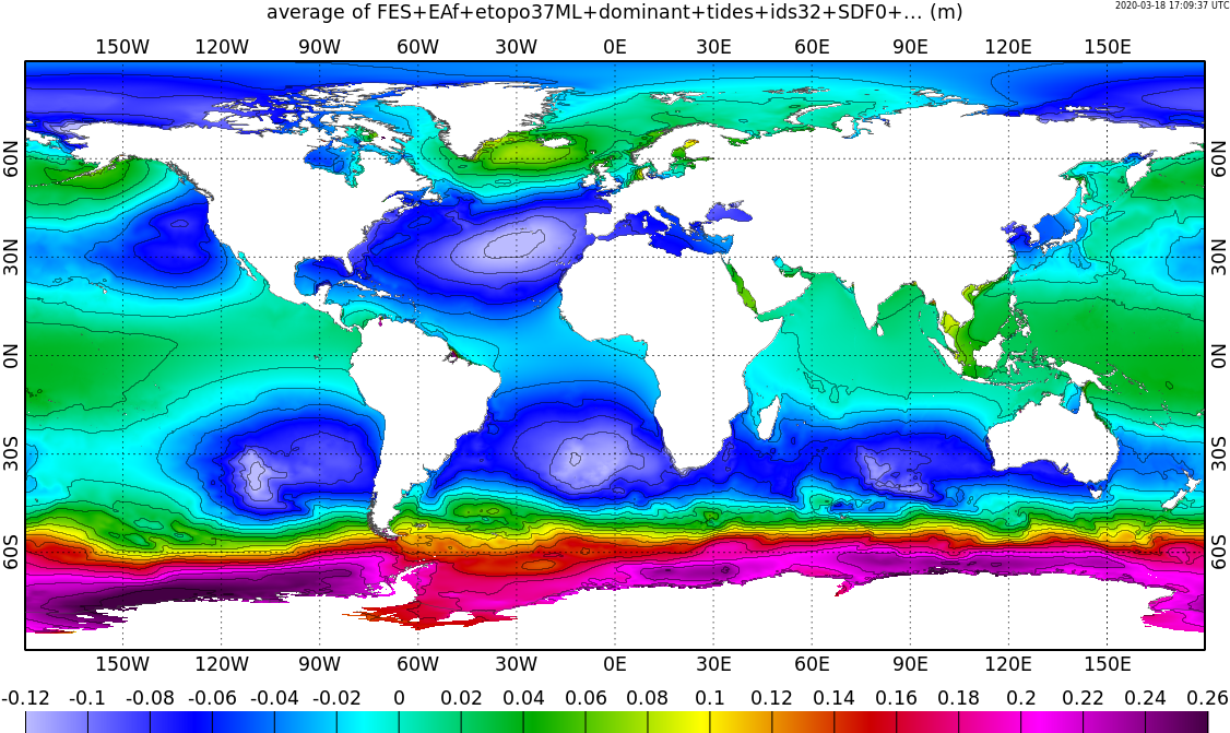
DAC is faily low below 30° of latitude. So I though it was likely that you may not need surges data for most areas of IRD interest. To let you see for yourself, I did some statistics on the detided output of the run with non-linear tides.
The plot of the average, next, shows that, apart from the Gulf of Venezuala, the Amazone estuary and the southern end of South America, the absolute value of the average is below 12cm.
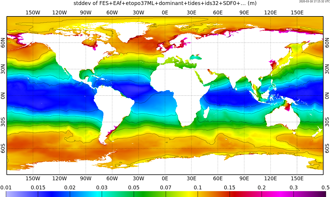
The plot of the standard deviation, next, shows the DAC may not be necessary for most areas apart from the Argentinian plateau, the German Bight, the Gulf of Carpentaria (16S 140E), the Yellow Sea and James Bay (52N 80W).
Extreme values will occur during storms. I believe that means cloudy conditions. I believe that also means no satellite images.
2 Which DAC should you choose ?
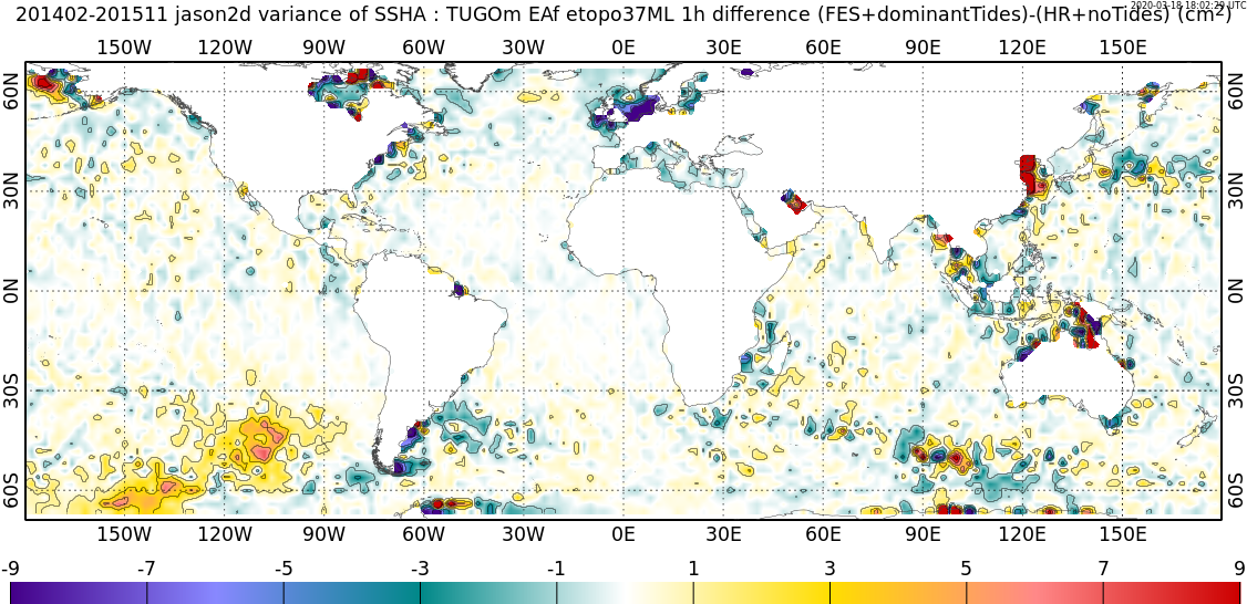
There is a choice of 2 DACs : the one without non-linear tides (readily available) and the one with non-linear tides (that will take at least 2 weeks). The difference of variances is shown next. Basically : blue-ish means with non-linear tides is better, red-ish means without non-linear tides is better. It is most likely coastal areas in red are due to a poor bathymetry, so we may need to iterate. I can not yet explain what happens below 30S in the Pacific Ocean.